
Mastering your Geography IA: from fieldwork nerves to analytical clarity
Think of the Geography IA as your chance to tell a story that pairs boots-on-the-ground observation with careful, evidence-driven thinking. For many students the IA feels like the steepest hill on the whole IB journey — and rightly so: it asks for a tidy research question, sound fieldwork, reliable data, thoughtful analysis and a reflective evaluation, all in one coherent piece. But with a little structure and a few practical habits, it becomes less a mountain and more a series of doable slopes.
This guide walks you through practical decisions that make the difference between a competent investigation and one that stands out: how to pick a tightly-focused question; how to plan realistic fieldwork; the kinds of data that actually speak to your question; ways to present and analyse results clearly; and how to write up in a way that shows maturity and rigour. Scattered through the article you’ll find small examples, checklists and a compact table that turns method choices into quick decisions you can use on the ground.
Start with a sharp, manageable research question
If your RQ is fuzzy, everything that follows will be wobbly. A great RQ is focused, measurable and feasible within the time and resources you have. Avoid questions that are too broad (“How does urbanisation affect the environment?”) and steer toward ones that define a variable, a place and a comparison (“How does surface temperature vary between two land-use types in the central park area?”).
Think in variables and operational definitions
Turn vague ideas into measurable terms. If your topic involves “vegetation health”, decide: will you use % canopy cover, NDVI from a handheld sensor, or a simple visual scoring system? If your focus is “river change”, define exactly what you mean — width, discharge, sediment size or channel depth — and how you will measure it. These operational definitions keep you honest and make data collection replicable.
Scale, scope and safety — the three quick checks
- Scale: Can you sample enough locations to make meaningful comparisons? Choose a scale you can cover in one or two field sessions if possible.
- Scope: Limit the number of primary variables to 2–3 that you can measure carefully rather than many you measure sloppily.
- Safety & access: Make sure you have permission and that the site is safe at the planned time — weather, tides, landowner access and COVID-era rules still influence fieldwork logistics.
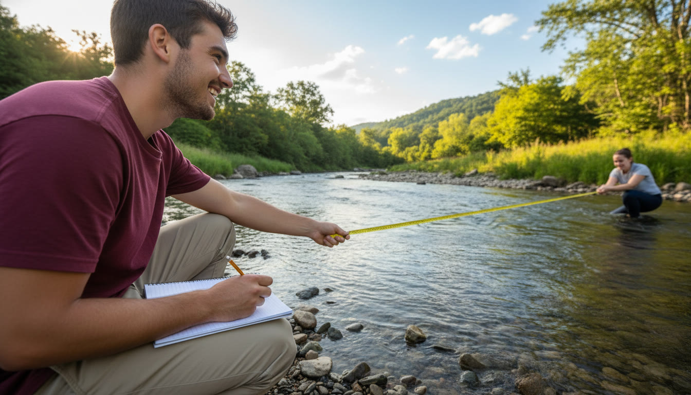
Planning fieldwork like a pro
Good fieldwork begins long before you step outside. Your planning should include a pilot test, clear equipment lists, sampling strategies and contingency plans. Treat the pilot as sacred: it reveals how long each measurement takes, exposes ambiguous instructions and often highlights overlooked ethical issues.
Sampling strategy: representative, repeatable and justified
Sampling is the backbone of a credible IA. Decide whether you will use random, systematic, stratified or purposive sampling and explain why. For example, if you’re comparing upstream and downstream river sections, systematic transects every 25–50 metres might be best; if you’re examining urban pedestrian behaviour, purposive sampling at peak times might be more revealing. Whatever you choose, state how you selected locations and why that selection helps answer your RQ.
Tools, timing and the pilot
- Tools: keep a checklist (clipboard, waterproof notebook, tape measure, clinometer, GPS-enabled phone, camera, thermometer, pH strips, grain-size cards). Calibrate where possible and record uncertainties.
- Timing: some phenomena vary daily (tides, commuter flows, temperature). Choose sampling times that match your question and be consistent.
- Pilot: a short pilot session will flag ambiguous instructions, time constraints and equipment failures. Use it to refine methods and calculate how many samples you can realistically collect.
Collecting robust, analysis-ready data
During fieldwork your aim is clarity and consistency. That means clear labels, consistent units, versioned datasets and a habit of recording uncertainties. Small habits here save huge time later.
Data hygiene: labels, metadata and error notes
Always label samples and photos immediately. Create a metadata line for each dataset that records site code, date, time, weather, equipment used and who collected the data. If a measurement is rough or estimated, note that. This transparency strengthens your analysis and evaluation.
Balancing quantity and quality
More data is not always better if each point is low-quality. Aim for a sample size that allows reasonable comparison but not at the cost of sloppy techniques. It is far better to have 20 carefully measured transects than 80 rushed, inconsistent ones.
Field tactics for common Geography IA types
Below are practical choices for common topics. Use the table to translate method choices into quick field decisions.
| Field Method | What it measures | Suggested sample approach | Quick tip |
|---|---|---|---|
| River transects (width, depth, discharge) | Channel form and flow dynamics | 10–15 transects along study reach; repeated measurements | Measure width and depth at consistent angles; repeat to check variability |
| Grain size/sediment pebbles | Energy and transport conditions | 30–50 pebble picks per site; record using phi or mm categories | Use a clean grid and consistent pick method to avoid bias |
| Transect vegetation surveys | Species presence and cover | Systematic quadrats at regular intervals | Photograph each quadrat and label photos with site codes |
| Human geography surveys (questionnaires) | Attitudes, behaviours, counts | Stratified sample across times/locations; aim 50+ responses if possible | Keep questionnaires short and pilot them for clarity |
Turning raw data into convincing analysis
Analysis is where you make sense of what you’ve collected. The best analyses are transparent about assumptions, thorough in method and creative in presentation. The techniques you choose should connect clearly to your RQ.
Clean first, analyse second
Begin by checking for transcription errors, missing values and obvious outliers. Create a clean dataset and keep the raw version saved separately. For numerical data, calculate central tendencies and variability (mean, median, standard deviation, interquartile range). For categorical data, produce frequency tables and proportions.
Choose visuals that answer, not just decorate
- Scatterplots: excellent for showing relationships and adding trend lines (linear or non-linear).
- Boxplots: show spread, medians and outliers — useful when comparing groups.
- Bar charts: clear for categorical comparisons and proportions.
- Maps and annotated photos: essential for spatial investigations — annotate features, scale bars and sample points.
When you present a graph, write one clear sentence that links it to your RQ: what the graph shows and why it matters. Avoid dumping all visuals without direct interpretation.
Analytical techniques to consider (and justify)
Some straightforward but powerful techniques that you can use and explain in your IA include:
- Correlation coefficients (e.g., Pearson or Spearman) to test strength and direction of relationships — explain why you chose parametric or non-parametric tests based on data distribution.
- Simple regression to model relationships and interpret slope and R², with clear statements about what the model does and doesn’t prove.
- Comparative statistics (t-tests or non-parametric equivalents) for comparing two groups — but only if your sample size and assumptions justify them.
- GIS mapping and basic spatial analysis (heatmaps, kernel density, buffer zones) to show spatial patterns — include a short methods box describing datasets and projections used.
Always explain assumptions and limitations of each technique — examiners value that critical awareness almost as much as the calculations themselves.
Write-up structure: clarity beats cleverness
A coherent structure helps examiners follow your reasoning. Use section headings and make sure every method links back to the RQ. A common and effective structure is:
- Title and RQ
- Background and justification (why this question matters locally)
- Methodology (site selection, sampling strategy, equipment and pilot)
- Results (clearly labelled figures and descriptive text)
- Analysis (interpretation, statistics, and links back to the RQ)
- Conclusion (directly answering the RQ)
- Evaluation (limitations, reliability, suggested improvements)
- References and appendices (raw data, extra maps, calculation screenshots)
Make appendices work for you
Appendices are the place for raw data, long calculation logs, full questionnaires and extra photos. Keep the main body focused — summary tables and selected figures should tell the story; appendices back it up. When you reference an appendix, be explicit: “See Appendix 2: raw sediment measurements” — that helps examiners navigate your evidence.
Language and academic tone
Write in clear, precise language. Use the passive and active voices judiciously: active voice makes methodology readable, passive voice works for describing what was done. Avoid flowery prose; short, evidence-linked sentences often score better. Proofread for consistency in units, decimal places and terminology.
Practical checklists and a sample timeline
Time management separates a high-quality IA from a rushed one. Below is a compact timeline you can adapt to your calendar. Treat fieldwork and data processing as the longest phases.
| Phase | Key tasks | Relative time allocation |
|---|---|---|
| Planning & pilot | Refine RQ, pilot methods, permissions | 15–20% |
| Fieldwork | Collect primary data, photos, site notes | 25–35% |
| Data processing & analysis | Clean data, visualise, run tests, map | 30–35% |
| Write-up & evaluation | Draft, revise, proofread, appendices | 15–20% |
Quick field checklist
- Paper map and GPS-enabled phone.
- Redundant measuring tools (two tape measures or two thermometers).
- Spare pens, waterproof notebook, and labelled sample bags.
- Consent forms for human participants and access permissions for private sites.
- Battery packs and camera memory cards.
Common IA pitfalls and how to avoid them
Knowing what goes wrong is useful; avoiding it is better. Here are repeated pitfalls students fall into and practical ways to dodge them:
- Overambitious scope: limit variables, or reduce spatial scale so each variable is measured well.
- Poorly justified methods: briefly explain why your sampling method is appropriate for the RQ.
- Insufficient replicates: if you can’t get many sample points, include repeated measurements at fewer sites to estimate variability.
- No record of uncertainty: always note measurement precision and possible sources of error.
- Letting appendices hide central data: include summary statistics and representative graphs in the main text.
How targeted support can fit into your IA process
Independent work is vital, but targeted guidance can sharpen your approach. One-on-one tutoring can help you refine a research question, design a pilot test, review data analysis choices and practise presenting results succinctly. If you choose to seek help, look for personalised tutoring that offers tailored study plans, expert tutors who understand fieldwork constraints and tools that provide data-driven insights into your progress. For example, Sparkl‘s personalised tutoring can provide one-on-one guidance, tailored study plans and expert feedback where you need it most.
Evaluation: be honest, be insightful
The evaluation is not a place for excuses — it is a space to demonstrate your critical thinking. Discuss precisely how sampling, equipment, timing and external factors may have influenced results. Propose concrete improvements: a larger sample, more precise instruments, alternative locations, or repeated measures across seasons. If a statistical test had assumptions you could not meet, say so and explain what that means for the strength of your conclusions.
Link limitations to reliability and validity
Differentiate between reliability (could the measurement be repeated with similar results?) and validity (does the measure actually capture the concept in the RQ?). Discuss both and explain steps you took to enhance each — calibration, pilot testing, consistent timing and cross-checks between observers are tangible actions to highlight.

Final polishing: presentation, referencing and submission prep
Before you submit, run a final checklist: are all figures labelled and referenced in the text? Are units consistent? Do table and figure captions describe what the reader should notice? Have you cross-checked numbers in text with tables and appendices? Ensure all sources are cited and formatted consistently — a short, clear reference list and a complete appendix for raw datasets strengthens the credibility of your work.
Parting practical tips to lift the grade
- Make every figure earn its place. If a chart doesn’t directly support your argument, remove it.
- Keep the RQ front and centre — each section should clearly feed back to answering it.
- Use annotated photos to demonstrate method transparency and site context.
- When using software for analysis, include a short methods note on settings (e.g., polynomial degree, bandwidth) so someone else could reproduce your steps.
- Practice explaining your investigation aloud — if you can summarise your approach and findings clearly in three sentences, your written work will be stronger.
Conclusion
Optimising a Geography IA is about asking a focused question, designing fieldwork you can deliver well, collecting clean data, analysing it with transparent methods and evaluating limitations honestly. Strong planning, a pilot that reveals hidden problems, clear labelling and careful analysis transform field notes into persuasive evidence. Apply these practices consistently and your investigation will not just meet the criteria — it will show the kind of independent, critical thinking the IB values most.


No Comments
Leave a comment Cancel